Difference between revisions of "ArcGIS"
Cris Porter (talk | contribs) |
|||
| Line 1: | Line 1: | ||
| + | == About ArcGIS == | ||
| + | From wikipedia: | ||
| + | ArcGIS is a geographic information system (GIS) for working with maps and geographic information. It is used for creating and using maps, compiling geographic data, analyzing mapped information, sharing and discovering geographic information, using maps and geographic information in a range of applications, and managing geographic information in a database. | ||
| + | |||
| + | == Availability == | ||
| + | ArcGIS is available for faculty and staff. Please contact support to arrange installation. | ||
| + | Students have access to a one year license of ArcGIS Desktop Student. This includes ArcGIS Desktop and the following extensions: | ||
| + | * 3D Analyst | ||
| + | * Geostatistical Analyst | ||
| + | * Image Analyst | ||
| + | * Network Analyst | ||
| + | * Publisher | ||
| + | * Schematics | ||
| + | * Spatial Analyst | ||
| + | * Tracking Analyst | ||
| + | * Data Interoperability | ||
| + | * Data Reviewer | ||
| + | * Workflow Manager | ||
| + | |||
| + | == Downloading ArcGIS Desktop Student == | ||
You can Download a student copy of ArcGIS by following this link to create an account: | You can Download a student copy of ArcGIS by following this link to create an account: | ||
http://www.esri.com/landing-pages/software/arcgis/arcgis-desktop-student-trial | http://www.esri.com/landing-pages/software/arcgis/arcgis-desktop-student-trial | ||
Revision as of 22:25, 18 March 2019
About ArcGIS
From wikipedia: ArcGIS is a geographic information system (GIS) for working with maps and geographic information. It is used for creating and using maps, compiling geographic data, analyzing mapped information, sharing and discovering geographic information, using maps and geographic information in a range of applications, and managing geographic information in a database.
Availability
ArcGIS is available for faculty and staff. Please contact support to arrange installation. Students have access to a one year license of ArcGIS Desktop Student. This includes ArcGIS Desktop and the following extensions:
- 3D Analyst
- Geostatistical Analyst
- Image Analyst
- Network Analyst
- Publisher
- Schematics
- Spatial Analyst
- Tracking Analyst
- Data Interoperability
- Data Reviewer
- Workflow Manager
Downloading ArcGIS Desktop Student
You can Download a student copy of ArcGIS by following this link to create an account:
http://www.esri.com/landing-pages/software/arcgis/arcgis-desktop-student-trial
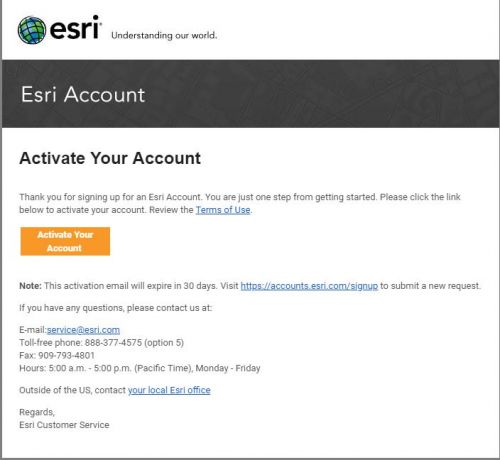
Once the account has been created check your email for for an activation email
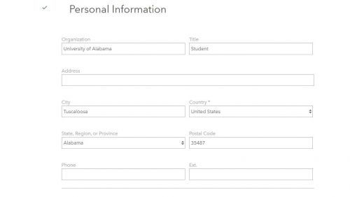
After clicking the button "Activate Your Account" follow the steps of filling out the information
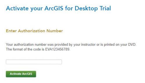
Next you will enter the activation code given to you by your instructor
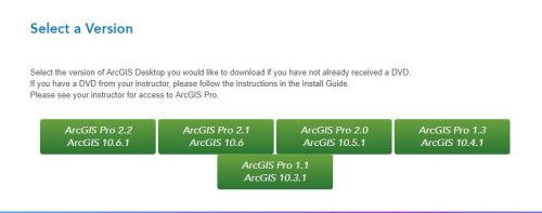
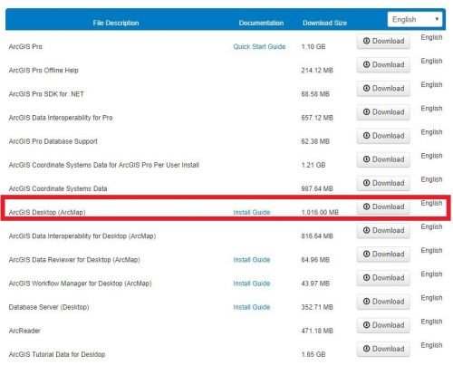
Now that the account has been activated you can select the version of ArcMap you would like to install
The next step is to select the download select the "download" button for "ArcGIS Desktop(ArcMap)"
